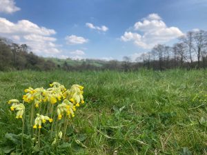
From urban Bath to wide green spaces. This flat loop uses Bath’s canal to navigate out of the city and the green finger of Bathampton Meadows to bring you back again.
Download the pdf for the full description and map
Start & Finish: Bath Spa train station *W3W – scrap.broke.chew
Distance: 6 miles / 9.7km with an up and down of 621 ft / 189m
Slopes: A mostly flat route
Steps & stiles: Several steps (no long flights), no stiles.
Terrain: Paved and unpaved paths. Can be very muddy in the winter in the meadows. Best done in wellies or avoided in the depths of winter.
Transport: Visit travelinesw.com. Bath Spa train and bus stations at the start. Pay and display city centre car parks. Alternatively start and finish in Batheaston where there is a car park and regular buses and join the route at point 3.
Public toilets: Southgate (city centre), Walcot Street near the library, Batheaston (20p)
Refreshments: Shops and cafés of Bath city centre and Batheaston. The Pump Shed café (seasonal opening hours), The Holburne Museum café, The George Inn, Bathampton and Morrison’s.
Rest points: Informal rest points on lock gates along the canal, benches along the canal, in Sydney Gardens, Kensington Meadows, Hedgemead Park and in Wild Walcot garden. Benches throughout central Bath.
Dogs welcome: Yes, though some urban walking, and livestock may be in some fields, so please be prepared to put them on a lead.
Wheel friendly: No
Features on the route: Kennet & Avon Canal, views to Clevedon Pools, Sydney Gardens and playground, Holburne Museum, Undercliff Urban Farm shop (seasonal opening times), Kensington Meadows and playground, Hedgemead Park and playground, Wild Walcot garden, Bath Abbey.