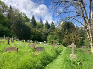
A figure of eight walk which can easily be split into two circulars. A varied route exploring this hidden corner of Bath and encouraging you to tune into all of your senses. A picturesque cemetery, wildflower meadows, fantastic views over Bath, a calming canal side & beautiful woodland.
Download the pdf for the full description and map.
You can take a quick tour of this walk with our short video –
Start & Finish: Widcombe Hill, opposite Prospect Place/Macaulay Buildings *W3W – chimp.mint.desk Can also be accessed easily from canal (point 2 on the map) if coming from Bath City Centre.
Distance: 2.1 miles / 3.4 km with an up and down of 454 ft / 138 m
Slopes: Long and steady descent down from the start, steady ascent in the woods and to return to the start.
Steps & stiles: No stiles, but a tree step over. Set of steps in the woodland (loop 2), and up from the canal (loop 1). A step free route can be taken around the cemetery.
Terrain: Unpaved paths, paved tow path and pavement. Woodland can be muddy in the winter
Transport: Visit travelinesw.com. Macaulay Buildings bus stop at the start on Widcombe Hill. Loop 1 can also be easily reached from Pulteney Road (A36). Free parking available near the start on Widcombe Hill. Very few 2hr limited parking bays available where Pulteney Gardens meets Horseshoe Walk.
Public toilets: No public toilets
Refreshments: The Pump Shed kiosk is open seasonally
Rest points: Benches in Smallcombe Cemetery, two benches on Bathwick Meadow, logs in Smallcombe Wood, arms of lock gates along the canal.
Dogs welcome: Yes, though be aware of grazing livestock intermittently throughout the year
Wheel friendly: No, though parts of the cemetery are
Features on the route: Kennet & Avon Canal, Bathwick Meadow Viewpoint, Richens Orchard, Smallcombe Cemetery & Smallcombe Woods.